
 Roads in BC were granular chip-seal. Definitely more obnoxious to cycle on.
The road also continued its pattern of occasionally going down a bluff to
the river, only to rise on the next hill. It would take a lot of extra
energy to slowly fight my way uphill, but I was fresh and going well.
Roads in BC were granular chip-seal. Definitely more obnoxious to cycle on.
The road also continued its pattern of occasionally going down a bluff to
the river, only to rise on the next hill. It would take a lot of extra
energy to slowly fight my way uphill, but I was fresh and going well.
Skies had been completely overcast. Shortly after 9am it started raining. A slow steady rain that would continue most the rest of the day. At km 930 I encountered the first section of gravel for the day. This continued for 8kms to Iron Creek Lodge where I stopped for a mid-morning snack.
The terrain after Iron Creek was the "old road" and had numerous descents and climbs. The grades were steep enough that I walked up an occasional hill. The rain was steady and miserable. This old road continued until ~km 900. At this point, the road crossed an old forest fire burn area and descended closer to the Liard River. It looks like it must have been beautiful scenery, but I was concentrating on keeping dry and warm.
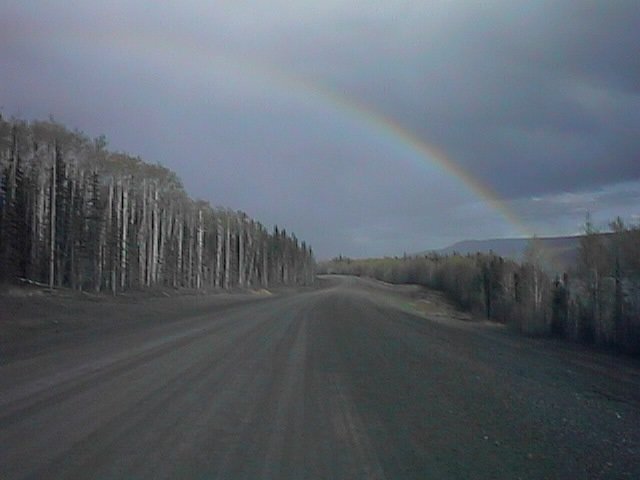
Slowly the miles counted down. At km 845 was another 6 kms of gravel.
At this point, the rain pretty much stopped for the day and there was
even a nice rainbow.
 The gravel ended at Fireside and I stopped. After traveling 47 miles since
the last break and 90 miles total, I was ready for an afternoon cheeseburger.
The rear wheel had started wobbling again pretty bad. I figured I would sort
it all out at Coal River just ten miles down the road.
The gravel ended at Fireside and I stopped. After traveling 47 miles since
the last break and 90 miles total, I was ready for an afternoon cheeseburger.
The rear wheel had started wobbling again pretty bad. I figured I would sort
it all out at Coal River just ten miles down the road.
At Coal River, there were three pieces of bad news. The most significant was that my rear rim was tearing apart. There would be no way to true it up, and it was only a matter of time before it collapsed. This was frustrating as I'd had this wheel just built up for the trip. It had only ~400 miles on it before the 970 miles I'd ridden these past two weeks. I wondered if I'd tightened it incorrectly or if it was going bad all along. Sigh.
The second piece of bad news was that the Coal River lodge, cafe and campground were all still closed for the season. Nothing like cycling 100 miles to find the destination closed. There was someone working on opening things up, but he was pretty unhelpful and unfriendly. Also he didn't particularly want me camping in his yard. With a sigh, I hit the road again.
The owner of the Coal River lodge told me a third piece of bad news, 10-12 miles of gravel road. Sigh. It was about 6pm, so I decided I'd try continuing as far as I could towards Laird River (37 miles away). If need be, I'd camp and cycle the rest before breakfast. I also figured it was only a matter of time before the rim collapsed, so I'd at least start heading towards Fort Nelson (rather than turn back to Watson Lake).
The gravel road was still wet. The mud got caught up in my front fenders. Despite loosening the brakes, I think my rear wheel was also rubbing. I was still somewhat hungry. Plod. Plod. I headed down the road. Several times, I'd slow to see if I could get some of the gravel paste from the fenders. The mud was also coating the drive chain.
At km 807 the gravel stopped, yeah! More coarse chip-seal, boo!. About km 795 I saw two buffalo grazing along the road. Not too much further the road went down and crossed the Smith River. More gravel road, oops! I didn't know how long it was going to last, but luckily it was only 4km. The day was starting to get long.
My wheel made it to km 780 before giving out. I descended a quick hill and heard a loud hiss as the tire blew. I expect that the tire got caught on the frame. Perhaps I could pump/patch the tire again, but this seemed somewhat pointless. I got off and started walking. I knew I had another 16 kms to Laird River, but perhaps I could get a ride.
About 2 kms further I saw a black bear ambling across the road. Uh oh! The
bear looked up at me with a curious look. Not quite certain what to do, I
decided to yell, "hey bear! hello there bear!" and whistle. (I know you are
supposed to yell, but, what are you supposed to say to these bears anyway?).
The bear looked at me even more curious. Finally, he decided myself and
bicycle were too much of a strange noisy contraption so he galloped across
the road and hid by the side in the bushes. The bear was still curious and
peered out my way as a I walked by.

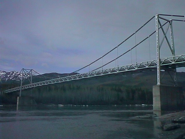
A little over 2 kms further, a truck stopped by. I waved. Folks there were kind enough to load myself and bicycle in the truck. We drove the remaining 11 kms to Laird River lodge.
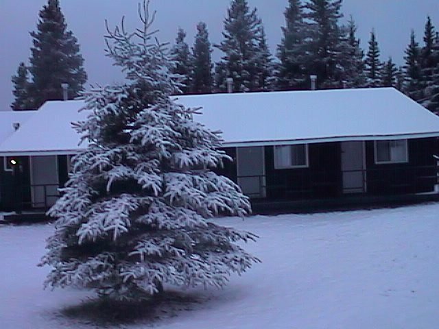
Sigh! The end of a long day. Almost 130 miles of cycling. Road
construction. Mechanical failure. Rain. Bears. All the adventures
at once. I found a spot in the government campground. This was also
close to some ideal natural hot springs. I would need to get on the phone
tomorrow to sort everything out. If I had to break down, fate had chosen
a nice place to do so.

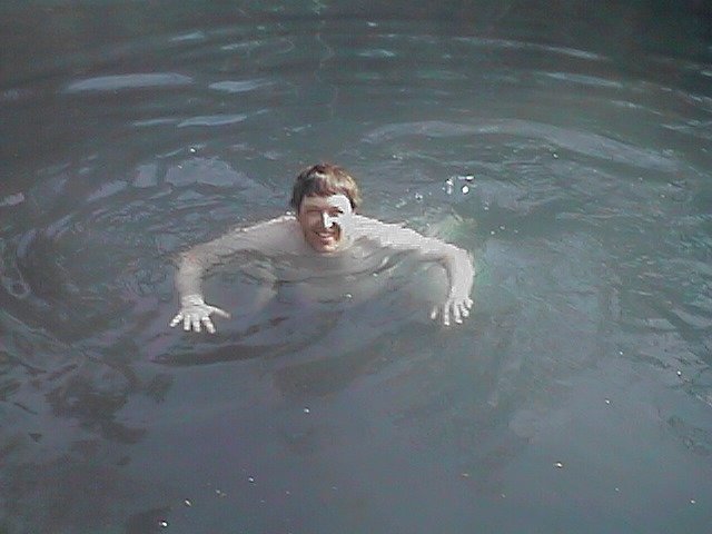
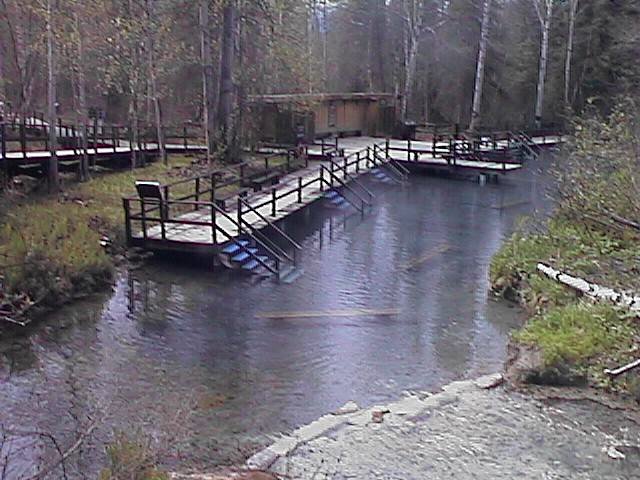
Relaxed again. Had a nice swim up at the hot pool. Completed a disassembler.
Dialed in to work using both the pay phone and later the phone at the lodge.
Also figured out further how the lodge worked. There was a couple who ran
the lodge. In the summer, they hired two cooks, two waitresses and a cleaning
person. With this staff, they ran the place during the summer.
I was done with the disassembler for a while, so I worked on my other big summer project: reading the bible from cover to cover. Read some in the morning. In the afternoon, Janet, one of the cooks, dropped me off at km 776 on her way to Watson Lake. It was her day off, so she was going in to the big city. She had lists from everyone at the lodge.
Janet dropped me off at km 776 so I could walk the 12 kms back to the bridge. This was a section where I'd gotten a ride, so I wanted to go back and do it under my own power. Pleasant afternoon walk, taking right around two hours. I saw another black bear. This one was by the km 770 sign. He was very still, enough so that I had to look good to see if he was stuffed. Nope, near as I know it was a real bear. I walked on. Later went to the hot springs to soak.
Around 7:30 the bus came. It had my wheel! Now I would need to call Griffen
to ask them not to ship anything up. With luck, I would be underway again!
![]()
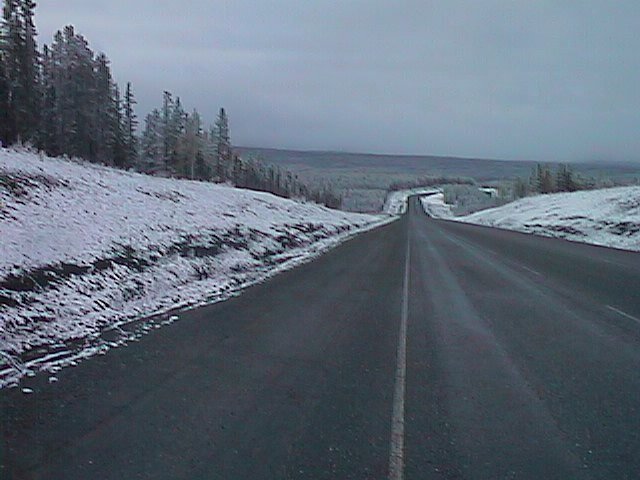
After a few miles along the Liard River, the road went up and over a bonus hill and then settled in to the Trout River Valley. Skies were beautifully clear and temperatures were in the high 40s. It was a wonderful day to be riding. The road slowly climbed from 1400ft at the bridge to 2750 feet at Muncho Lake. It was very apparent that I was slowly heading into the Rocky Mountains as towering white peaks came up on the sides.
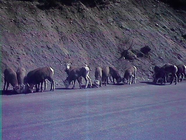 Crossed into Muncho Lake Provincial Park. Just past the first overlook
to the lake, a herd of Stone Sheep were grazing right along the road.
Apparently, they are attracted by the salts and other minerals along
the road. Stopped twice at Muncho Lake for lunch. At the south side,
a grilled cheese and the north end a cheeseburger. The lake itself was
magnificent. It was mostly frozen, although in some thawed parts one could
see reflections of nearby peaks. At the first lunch spot, I called Griffen
Sports to cancel my order (they still hadn't gotten the rim in, so if I
had continued to wait on them it would have been at least two more days...)
Crossed into Muncho Lake Provincial Park. Just past the first overlook
to the lake, a herd of Stone Sheep were grazing right along the road.
Apparently, they are attracted by the salts and other minerals along
the road. Stopped twice at Muncho Lake for lunch. At the south side,
a grilled cheese and the north end a cheeseburger. The lake itself was
magnificent. It was mostly frozen, although in some thawed parts one could
see reflections of nearby peaks. At the first lunch spot, I called Griffen
Sports to cancel my order (they still hadn't gotten the rim in, so if I
had continued to wait on them it would have been at least two more days...)
Out of Muncho Lake the road continued to climb, reaching ~3400ft at a
drainage divide over to the Toad River.
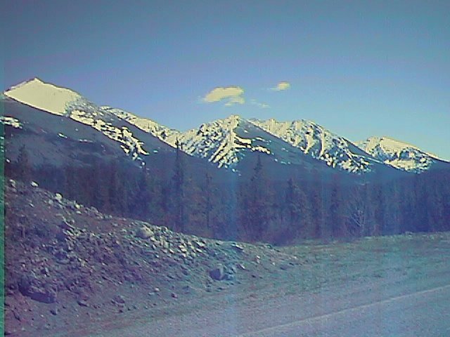 The climb was mostly gradual, although it took some extra effort.
This was fine as the scenery continued to be dramatic. Over Muncho Pass
descent! One stretch marked as 3kms of 7% grade. Occasional short
climbs, but nothing too bad. After a few miles reached the Toad River and
then followed it at a more gradual descent down to the town of Toad River.
While it was only 4pm, I decided to stop for the day. There would be
plenty of further mountain climbing left and no point in wearing out.
The climb was mostly gradual, although it took some extra effort.
This was fine as the scenery continued to be dramatic. Over Muncho Pass
descent! One stretch marked as 3kms of 7% grade. Occasional short
climbs, but nothing too bad. After a few miles reached the Toad River and
then followed it at a more gradual descent down to the town of Toad River.
While it was only 4pm, I decided to stop for the day. There would be
plenty of further mountain climbing left and no point in wearing out.
Toad River Lodge is known for the hat collection hanging on the ceiling and
on the walls. The white board indicated 4727 hats in the collection.
![]()
Despite the hills, I was making reasonable time. I saw several white-tailed deer and also some caribou. In total today was one with the most wildlife so far (two moose, four caribou, many many Stone Sheep,...). I was stopped on one hill and a pickup honked several times before stopping. The driver wanted to warn me that he'd seen a black bear ten miles down the road. I thanked him, though didn't think there was much I could do (other than being careful not to startle said bear). I never did see the bear.
At km 615 I passed the 115 Creek campground. The road really started to
climb (signs at the top said 8% grade). I put things into a low gear and
slowly ground out the miles. I startled some Stone Sheep around one corner.
A couple in a red car were filming. They were from Chicago and thought
Fairbanks was a long way away. I of course thought Chicago was far as well,
so we were even. I refueled at a lodge at 605km and continued
climbing. The top came at 602km. Hooray!
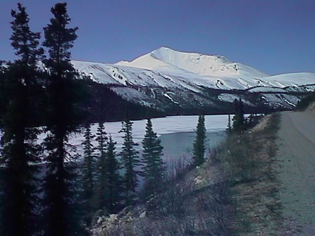 At the top was a small lake and shortly thereafter was Summit Lake. It was
mostly frozen, although there was a small patch thawed. This was the highest
At the top was a small lake and shortly thereafter was Summit Lake. It was
mostly frozen, although there was a small patch thawed. This was the highest
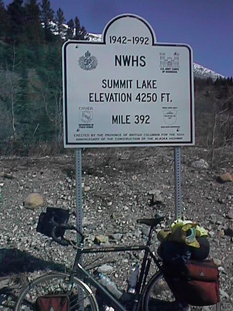 point on the Alaska Highway, so I stopped for the requisite fotos. Just
beyond was a lodge to have lunch. Apparently, Summit Lake had last seen snow
just a week before.
point on the Alaska Highway, so I stopped for the requisite fotos. Just
beyond was a lodge to have lunch. Apparently, Summit Lake had last seen snow
just a week before.
Descent! Wow, the road continued down and down once I passed Summit Lake. Even the mostly flat sections along the Tetsa River seemed to be downhill. It was nice getting payback for all that climbing. The road continued flat or downhill most of the way to km 560.
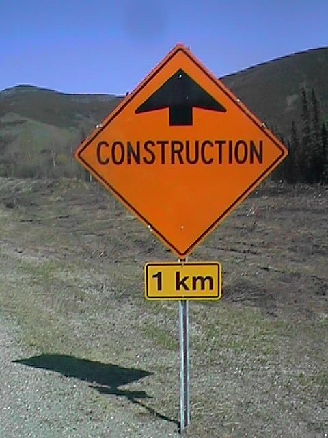 Steamboat. This is a name I'd been hearing from tourists ever since the
Alaska border. The construction at Steamboat was notorious for the delays,
for the mud and for being awful. As the road made a sharp descent and
climb at km 554, I was filled with anticipation for the construction ahead.
After 554, the road was sharp and steep. I slowly pedalled my way up to
545. At this point, a flagger was holding traffic for a pilot car.
Steamboat. This is a name I'd been hearing from tourists ever since the
Alaska border. The construction at Steamboat was notorious for the delays,
for the mud and for being awful. As the road made a sharp descent and
climb at km 554, I was filled with anticipation for the construction ahead.
After 554, the road was sharp and steep. I slowly pedalled my way up to
545. At this point, a flagger was holding traffic for a pilot car.
They insisted that my bicycle be placed in back of the truck. I waited with other cars for the pilot truck to arrive. The actual construction was much better than reported (it looked better than some stretches I had ridden).
The pilot car let me off at the top of Steamboat mountain. From here it was
a short descent down to the Steamboat Cafe. I decided to camp here, so that
I could have an easy day and some business hours left in Fort Nelson.
![]()
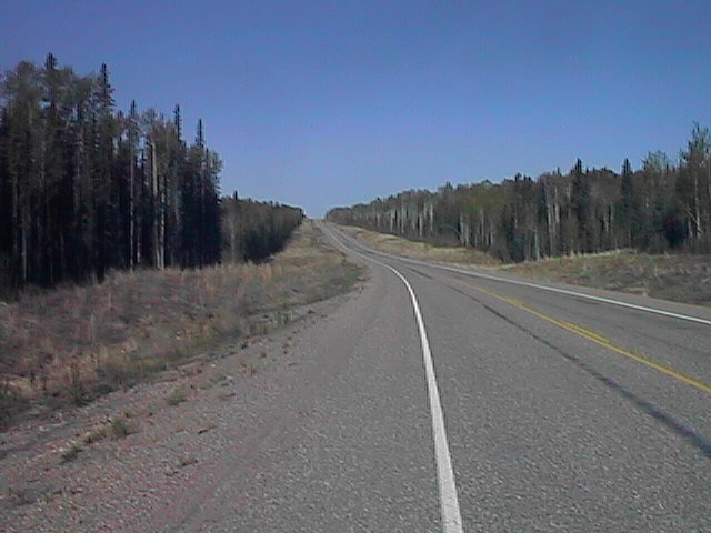 Cool morning air as I left. The initial ten miles were a pretty consistent
descent off Steamboat Mountain and down towards Steamboat Creek. Road was
a somewhat coarse chip-seal. By the time I got to the bottom, I could
take my mittens off. From this point, the terrain was gently rolling with
some long mostly flat sections. These mostly flat sections were deceiving.
Where they went uphill, I would wonder why I had to cycle in a lower gear.
Where they went downhill, I would feel really good about the time I was
making.
Cool morning air as I left. The initial ten miles were a pretty consistent
descent off Steamboat Mountain and down towards Steamboat Creek. Road was
a somewhat coarse chip-seal. By the time I got to the bottom, I could
take my mittens off. From this point, the terrain was gently rolling with
some long mostly flat sections. These mostly flat sections were deceiving.
Where they went uphill, I would wonder why I had to cycle in a lower gear.
Where they went downhill, I would feel really good about the time I was
making.
I passed the turnoff to Fort Laird, N.W.T. Looked like a long and quiet gravel road. From here the terrain flattened some, though the wind picked up slightly. About ten miles from Fort Nelson, I could see fields that had been recently cleared. Large piles of brush and other debris were still to be found. Passed by the turnoff to the golf course! Wow, must be coming in to a big city now. It was about 11:15 when I arrived in Fort Nelson.
Decided to stay in town. The first chance to update the web pages
in ten days. Also, a chance to drop by a bank and a laundromat. I
also stopped by CMP sports to have them adjust the derailer. I also bought
a new odometer. Winds were still from the south today, but were forecast
to switch tomorrow!
![]()
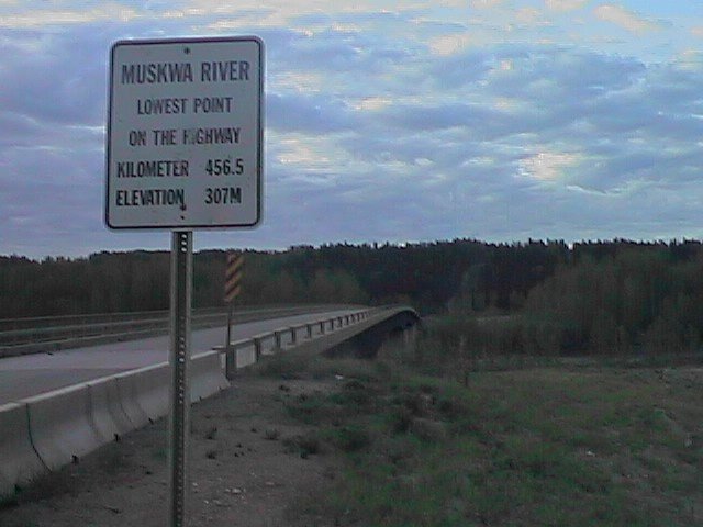 Rode five miles before breakfast. Descended down to the Muskwa River and
the lowest point on the Alaska Highway, 1000ft. Climbed up to Muskwa Heights
truck stop for breakfast. On my way out of town, I passed the board plant,
the chopstick factory, the Natural Gas plant and the sulpher reprocessing
plant. (Sulpher is a greenish tint? At least some byproduct was in large
chartruse piles).
Rode five miles before breakfast. Descended down to the Muskwa River and
the lowest point on the Alaska Highway, 1000ft. Climbed up to Muskwa Heights
truck stop for breakfast. On my way out of town, I passed the board plant,
the chopstick factory, the Natural Gas plant and the sulpher reprocessing
plant. (Sulpher is a greenish tint? At least some byproduct was in large
chartruse piles).
Tailwinds! Winds were out of the north at about 20 km/h. Skies were overcast with intermittent showers through the day. The road out of Fort Nelson was a much smoother pavement. It was great to zoom down the road at a high gear. There may have been some slight hills, but I didn't notice. I was musing that my front wheel had likely done approximately a million rotations on the trip so far.
At km 370 the road passed Mount Yakatchie and also made a turn into the wind and then up a large hill. What a contrast! As I got to the top of the hill, sprinkling rain was replaced with a harder downpour. Luckily, I was within five miles of Prophet River.
56 miles at Prophet River, and it was still before 11am! Decided to continue until at least the next place, Buckinghorse River, 55 miles further. I prepared to ride off in the rain when I noticed my rear tire was going flat. Sigh! I carefully got the tire out, inspected it, but couldn't find the leak! I carefully wiped in tire clean and then put in a fresh tube. I did notice that CMP Sports had neglected to put in a rim strip. The intermission to replace the tire was sufficient for the rain cloud to pass and it to change back to sprinkling. There was even some sun. Nice timing I guess.
Eleven miles down the road, as I passed the Prophet River Campground, I
noticed the rear tire was soft again! This time, I was more fortunate to
have a nearby pond at the campground. The leak was on the inside where
the spoke hole was. It was because of the missing rim strip!
 I didn't have another rim strip. Earlier, I had tried removing one from my
old rim, but it was on too tight. I did however has 1/4" electrical tape
which worked exactly right. This tube wouldn't patch, so another spare tube
later, I was rolling again.
I didn't have another rim strip. Earlier, I had tried removing one from my
old rim, but it was on too tight. I did however has 1/4" electrical tape
which worked exactly right. This tube wouldn't patch, so another spare tube
later, I was rolling again.
After km 350, the winds died down some, at the terrain started to climb and descend more. The road was also less smooth. My zoom speed slowed down. After km 320, a range of mountains again appeared. I was riding on the "new road". In one segment, highway realignment had replaced 132 curves from the old road. In another segment, the road now bypassed Trutch Mountain. This has been the second highest point on the highway, at 4134ft.
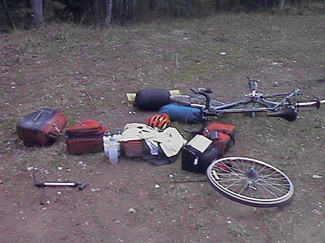
After km 305, I was getting tired and also ominously noticed my rear wheel wobbling some. Not again! I decided I would stop at km 279 for the day. The last two kms were downhill. The wheel was definitely out of true.
At the lodge, I inspected the rear wheel. Almost half the spokes on the
non-freewheel side were loose. It was also majorly out of true. Luckily
the rim itself looked ok and the spokes were good. I spent forty-five
minutes getting things mostly together. Hopefully they would last at least
to Fort St. John, another 125 miles further.
![]()
 It snowed. There was approximately an inch on the ground when I awoke and
it was still coming down. I encountered snow showers throughout the day
until about 4pm. Sometimes they were pretty heavy and fierce. Luckily,
accumulations went away as I headed further south.
It snowed. There was approximately an inch on the ground when I awoke and
it was still coming down. I encountered snow showers throughout the day
until about 4pm. Sometimes they were pretty heavy and fierce. Luckily,
accumulations went away as I headed further south.
I wasn't too worried about the snow, since the roads were still wet (except for bridges, where some stuck). I was much more worried about that back rim. It looked like it was going ok, but at 8 miles I stopped and found two spokes completely loose. From this point for the next 25 miles, I stopped every 5km or 10km, and either tightened spokes or trued the wheel. This could be a long trip to Fort St. John. At km 240, I tightened something right, and the spokes stopped loosening! I trued the wheel twice after that, but things went a lot better. The road also smoothed out, which I think helped.
The route climbed over the drainage and then descended steeply to Sikanni
 Chief. Signs on the hill indicated an 8% grade for 2kms. The snow covered
forests were beautiful. The snow itself coming down was obnoxious. I
went a bit slowly, due to the spokes and keeping my glasses clean. Luckily,
after Sikanni, the road went back to gently rolling hills and then a descent
to the Pink River Valley. There were several horses here right next to the
road, including a foal. At this point, the road climbed up to 3500ft to the
Pink Mountain Motel where I stopped for a second breakfast.
Chief. Signs on the hill indicated an 8% grade for 2kms. The snow covered
forests were beautiful. The snow itself coming down was obnoxious. I
went a bit slowly, due to the spokes and keeping my glasses clean. Luckily,
after Sikanni, the road went back to gently rolling hills and then a descent
to the Pink River Valley. There were several horses here right next to the
road, including a foal. At this point, the road climbed up to 3500ft to the
Pink Mountain Motel where I stopped for a second breakfast.
I continued from Pink Mountain south. Occasionally fighting a fierce snow squall, but usually riding in light precip. The route continued mostly along the tops of the drainages, but twice near km 200, it descended into a valley only to slowly climb out. I was pretty slow on those climbs.
For the past day, I had been travelling through an active natural gas field. Westcoast Energy was one of the primary developers. There were plenty of survey crews out. I passed by multiple compression stations and also saw a number of flares.
A late lunch at Wonowon (named for being mile 101 on the highway). At this point it was almost four and a snow squall was again beginning. I debated trying another 28 miles and decided to do it. The snow was fierce, almost making me reconsider. However, just as I was beyond point of now return, it dried up and cleared up. Hooray! On the way in I had a first debris thrown at me. Some kids in a truck decided to throw a milk carton. Sigh. Not that it hit, but seemed to be a shame littering.
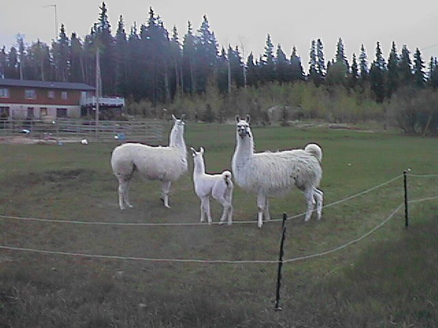 I saw a few friendly and inquisitive llamas just as I completed a century.
Not too much further I pulled in to the Shephard's Inn, only to see a
"closed" sign. Uh oh. Luckily, someone came out and explained that the
restaurant was closed on Sunday, but they were still renting motel rooms.
They also actually made me dinner as well. Nice friendly people.
I saw a few friendly and inquisitive llamas just as I completed a century.
Not too much further I pulled in to the Shephard's Inn, only to see a
"closed" sign. Uh oh. Luckily, someone came out and explained that the
restaurant was closed on Sunday, but they were still renting motel rooms.
They also actually made me dinner as well. Nice friendly people.
![]()
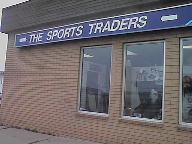 The wobble in the wheel wasn't too bad anymore, but I decided to let a bike
store work with it. Also, I'd been noticing almost a skipping in the drive
chain when I cycled. Decided to have that looked at also. Griffen cycles
had their mechanic out. Sports Trader had one in and told me they'd look
at it right away.
The wobble in the wheel wasn't too bad anymore, but I decided to let a bike
store work with it. Also, I'd been noticing almost a skipping in the drive
chain when I cycled. Decided to have that looked at also. Griffen cycles
had their mechanic out. Sports Trader had one in and told me they'd look
at it right away.
Wandered through Main Street. Saw a nice art exposition by local secondary
school students. Read the Edmonton paper (more rain for a few days?).
Otherwise found a motel in town. When the bike was ready, I picked it up.
Looked like it rode somewhat better, though the true test would come tomorrow.
One more day to Dawson Creek!
![]()
Left Fort St. John around 5:30. I had intended to get breakfast before I
left, but found the signs that said "open at 5am" were untrue. Cycled
mostly downhill to Taylor. Taylor was a small town on the banks of the
Peace River. It looked like there was a large gas processing plant right
in town.
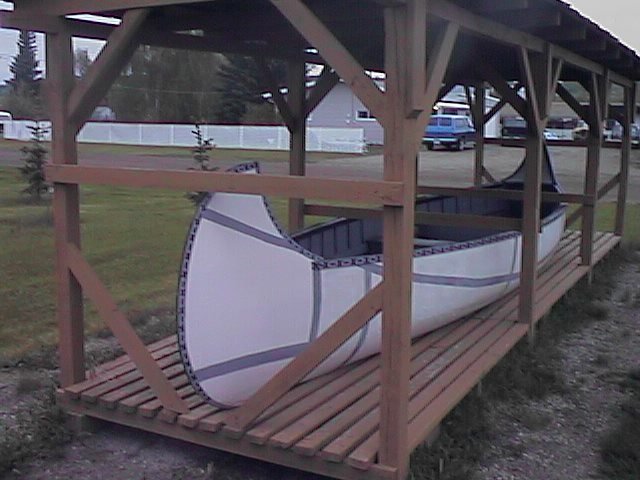 There was a display of a canoe similar to that Mackenzie had used
in searching this area for the northwest passage.
Good breakfast at the cafe which was now open.
There was a display of a canoe similar to that Mackenzie had used
in searching this area for the northwest passage.
Good breakfast at the cafe which was now open.
After Taylor, several miles of steep hill to climb to get out of the river valley. Bicycle rode well, although the rear wheel was trued off-center (i.e. away from the freewheel side). Hopefully nothing serious here.
Signs kept counting down to Dawson Creek. 30km, 25km, 20km... I had a sense of anticipation as I was finally coming to the end of the Alaska Highway. Several drainages to cross with nice descents and slow climbs. This region had some farming and ranching. First real agriculture since a hint at Fort Nelson and then before in Alaska.
Stopped in Farmington. Found they had a small post office, so I decided to mail a few unused things home: sweater, neoprene booties (good idea, but not used),... Only 1.85kg but every little bit helps. After that cycled in to center of Dawson Creek.
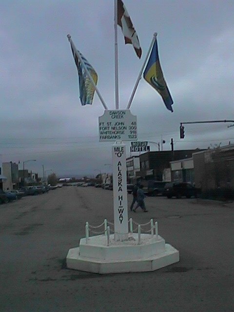 Stopped for the obligatory "Mile 0" pictures, and then found the post office.
Picked up my mail (took 12 days to arrive!), paid a bill and then sent stuff
off again. Stopped for an early lunch at McDonalds, 47 miles behind me.
Stopped for the obligatory "Mile 0" pictures, and then found the post office.
Picked up my mail (took 12 days to arrive!), paid a bill and then sent stuff
off again. Stopped for an early lunch at McDonalds, 47 miles behind me.
After lunch, I decided to continue. It was a strange feeling to be cycling on. For so long, I'd been tracking progress towards Mile 0. Also, I had the complete "Milepost" scanned into my PC, so I knew all the stops. From here it would be less known which accomodations could be found where. Wow.
The region continued with some agriculture, some woods and also some rolling hills. Saw both a reindeer farm and an ostrich farm. Also saw active work of beavers. Passed Pounce Coupe and then counted down 32kms to the Alberta border.
Alberta! Finally a new province. The road got a nice six-foot shoulder. There was one slight hill. Folks at the gas station had tried to scare me about the "big hill", so I wasn't completely certain I'd climbed it. However, after that hill, it became very flat and open. Some trees, but also lots of open land. Apparently, canola is a common crop, though they'd had too much rain to start planting yet.
 Passed through Hythe, which was a real cute little prarie farming town
then followed the railroad tracks along to Beaverlodge where I decided to
stop for the day. The nice flat terrain of the last 20 miles was a nice
contrast to stuff I'd been having earlier.
Passed through Hythe, which was a real cute little prarie farming town
then followed the railroad tracks along to Beaverlodge where I decided to
stop for the day. The nice flat terrain of the last 20 miles was a nice
contrast to stuff I'd been having earlier.