
This weather was getting old. Almost twelve hours on the road to travel only 85 miles. At times I was pushing hard to travel 6 mph, knowing that if only I were going the other way I would more than triple my speed. Sigh. Unlike a hill, where one has a view or fun descent, this wind couldn't promise a payback. At those times, I reminded myself, this was my vacation, I was having fun and then pushed on. Also, fortunately, the winds shifted to SSE. The first 20 miles were directly into the wind, but the rest of the day was more of a diagonal cross-wind.
Left early, time had changed another hour yesterday (Saskatchewan is also
on Central Time, but does not observe daylight savings). Ranchland and
farmland as I cycled south to Binscarth. Here the road turned directly
into the wind until Foxwarren. Stopped here for breakfast. The local
cafe had a fundraiser on the wall, "cow bingo". Apparently the way the game
is played is to divide a field into 100 squares. A cow is then allowed to
wander. The first square to acquire a cow patty wins.
 I can imagine the poor cow being watched and yelled at.
Gusty wind after breakfast. Fortunately, the road turned and the wind
became a cross-wind. Slowly but surely I ground my way upwind. It seems
that this part of the prairies may have originally had trees. Dropped in
through Shoal Lake to find a lunch spot, only to be directed back to the
highway. After Shoal Lake the road mostly followed the railroad on in to
Minnedosa. The shoulder also became paved after Shoal Lake.
Minnedosa is a small town of ~3000 and biggest around.

![]()
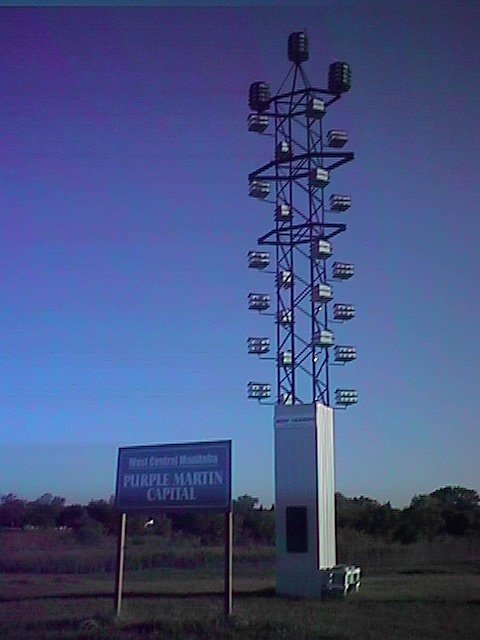 In little time, I made it to Neepawa where I found this large purple
martin house. Neepawa proclaimed itself as the "purple martin capital
of west central Manitoba". Here I also made the first of five crossings
of the Whitemud River. It was brown.
In little time, I made it to Neepawa where I found this large purple
martin house. Neepawa proclaimed itself as the "purple martin capital
of west central Manitoba". Here I also made the first of five crossings
of the Whitemud River. It was brown.
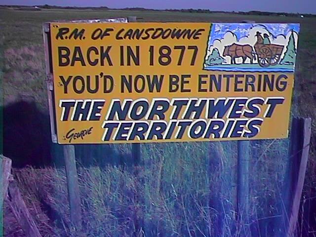 The shoulder had shrunk to 18 inches, but traffic was light. I didn't
realize the original North West Territories had extended this far east.
Several farms in this area advertising their Charalais cattle.
Continued straight, flat roads allowed me to make it to mile 43 and
Gladstone before I stopped for breakfast.
The shoulder had shrunk to 18 inches, but traffic was light. I didn't
realize the original North West Territories had extended this far east.
Several farms in this area advertising their Charalais cattle.
Continued straight, flat roads allowed me to make it to mile 43 and
Gladstone before I stopped for breakfast.
After Gladstone the wind started picking up again. Pretty much straight
from the south and thus mostly a cross-wind. Unfortunately, the road
also started to turn more southward. Passed towns of Woodside and
Westbourne which looked extremely small. From this point, I had 13 miles
almost directly into the wind.
 I was worn out by the time I reached the trans-Canada highway (TCH). Stopped
in for a snack and then headed eastwards. Unfortunately, I found that
this stretch of the TCH had gravel shoulders! Only 3 inches
to the right of the line on a two-lane expressway. There was a frontage
road which I briefly tried. It was soft gravel. I came back onto the
main highway. Luckily, the traffic gave me some room. Got into
Portage La Prairie a little after 3pm. Decided I'd stop for the day and
tackle the remaining distance into Winnipeg tomorrow. Gusty winds helped
make that a bit easier to decide.
I was worn out by the time I reached the trans-Canada highway (TCH). Stopped
in for a snack and then headed eastwards. Unfortunately, I found that
this stretch of the TCH had gravel shoulders! Only 3 inches
to the right of the line on a two-lane expressway. There was a frontage
road which I briefly tried. It was soft gravel. I came back onto the
main highway. Luckily, the traffic gave me some room. Got into
Portage La Prairie a little after 3pm. Decided I'd stop for the day and
tackle the remaining distance into Winnipeg tomorrow. Gusty winds helped
make that a bit easier to decide.
![]()
 Today a longer day than originally expected. Left Portage just as the
sun was coming up. Winds out of the south, so mostly cross-winds. When
I reached the TCH, I found this section also had gravel shoulders. Luckily,
traffic was light and gave me plenty of room. The crops had been recently
planted and were about 2 inches high.
Today a longer day than originally expected. Left Portage just as the
sun was coming up. Winds out of the south, so mostly cross-winds. When
I reached the TCH, I found this section also had gravel shoulders. Luckily,
traffic was light and gave me plenty of room. The crops had been recently
planted and were about 2 inches high.
After breakfast, strengthening cross-winds. Luckily they were from due south, so at least not a headwind. Stopped in at a truck stop at mile 40. Figured out how to get through Winnipeg. Decided to get off and take secondary roads. As I got close to Winnipeg, the cross-wind was so strong that it would have knocked my helmet off if it wasn't strapped on. Thought about taking my glasses off to avoid having them blown off.
At mile 44, I crossed the ring road into Winnipeg.
 I may have gotten lucky, but transit across this city was easier than
expected. In contrast to rural roads, the city roads were better than
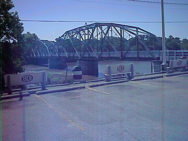
Edmonton. Reached the Red River at mile 55. This was the river of the
recent floods: Grand Forks USA, and also many small towns in Canada.
They were still cleaning up and had only opened Highway 75 a week ago.
Left town through an industrial area and reached the ring road at mile 65.
I may have gotten lucky, but transit across this city was easier than
expected. In contrast to rural roads, the city roads were better than
Edmonton. Reached the Red River at mile 55. This was the river of the
recent floods: Grand Forks USA, and also many small towns in Canada.
They were still cleaning up and had only opened Highway 75 a week ago.
Left town through an industrial area and reached the ring road at mile 65.
At this point I had several choices leaving Winnipeg. One would be to follow the TCH out of town. Unfortunately, this angled into the wind. It was strong enough and gusty enough that I didn't think I'd get very far. Hence, I decided instead to head due east on Highway 15. This would alter the route for the next ~100 miles, but was only 3 miles longer. Fortunately, it was also directly east and thus only a strong cross-wind.
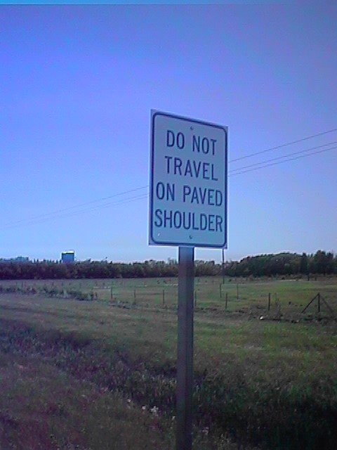 I luckily found out that this route had a paved shoulder. Rare enough
in Manitoba that they put up signs. Reached Dugald at mile 70 and
stopped out of the wind to recharge. Here I heard of the Anola Motor Inn,
only 9 miles further! Great, this cross-wind was wearing me out, so
I would be ready to stop.
I luckily found out that this route had a paved shoulder. Rare enough
in Manitoba that they put up signs. Reached Dugald at mile 70 and
stopped out of the wind to recharge. Here I heard of the Anola Motor Inn,
only 9 miles further! Great, this cross-wind was wearing me out, so
I would be ready to stop.
Slowly made my way to Anola. Motel closed. They were turning it into suites and renting it out long term. Alternatives given were to head south into the wind for 21 kms to Ste. Anne. Nope, this wouldn't work. Also, could head north for 21 kms to Beausejour. This would work, but would mean extra distance tomorrow. Turnoff to Beausejour was in 13 kms.
Anola is at the treeline at the edge of the Prairie. Wow! There were now trees along the way. It made a dramatic difference. As I cycled towards the Beausejour turnoff, I realized that it was much easier without the cross-wind. I decided to bypass the turnoff and continue ahead instead. Elma was only 33 miles away.
Forest, trees! A dramatic difference from the open prairies. My "official"
transition out of prairies would occur at Kenora, but it was nice to reach
the edge. Cycling went much easier, though I was also somewhat worn out
by the long day. I pushed on to Elma at mile 112.
Here I found the Elma Hotel was closed, but another hotel was at Whitemouth.
Without much else to do, I pushed the last eight miles. 120 miles overall.
Arrived 7:30pm, some 14 hours after starting.
![]()
Out of Whitemouth I cycled through the Whiteshell Provincial Forest.
I passed Rennie at mile 21. The cafe didn't open until 9am, so I continued
on.
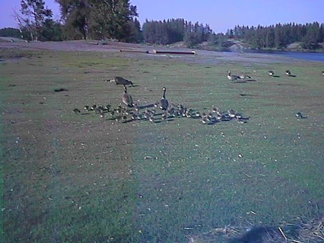 I passed by the Alfred Hole goose sanctuary, population 127. There were
many goslings wandering around.
I passed by the Alfred Hole goose sanctuary, population 127. There were
many goslings wandering around.
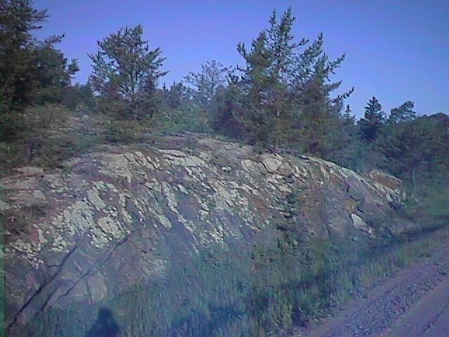
Out of Rennie, route 44 became narrow and windy as it passed through the
woods. At many places, there was exposed bare rock. There were lots of
bogs and swamps.
 The road climbed over little hills and twisted around bends. The road
surface was also relatively poor. My back wheel was going out of true
again :-(. However, overall I really enjoyed this road.
The road climbed over little hills and twisted around bends. The road
surface was also relatively poor. My back wheel was going out of true
again :-(. However, overall I really enjoyed this road.
At mile 43, I stopped for a late breakfast at Westhawk, before rejoining the TCH. I was a mile or two from the Ontario border. Stopped in at the official border station to get Ontario information and a map. The clerk wasn't particularly helpful about road conditions other than to mention lots of road construction ahead.
Different wildlife here than on the plains. I saw bearproof enclosures again. Passed close to a deer and also brushed off a tick from my socks. The road also started having small hills, though nothing severe.
Road construction started at mile 55. They had removed the top asphalt surface and left those narrow grooves. Obnoxious to cycle on. Also, they removed the shoulder itself, so I was forced out onto the roadway. TCH is only one lane each way here. Fortunately, most traffic was polite. This road continued torn up to mile 63.
Had lunch and inspected my wheel a bit closer. Uh, oh. The rim itself was starting to crack where the spokes pulled out. I had seen this once before; about 200 miles before my original wheel gave out. Fortunately, I was able to cycle without much trouble to Kenora at mile 78. Here I stopped at the "Waves" cycle shop. Decided I'd let them build yet another wheel. I didn't have the tools to do a "hot swap" my auxiliary wheel out back, and was also cautious with several hundred miles of mostly forest ahead. They needed to get a rim shipped from the Winnipeg store, so hopefully not too long of a layover. This would allow me some time to explore Kenora tomorrow.