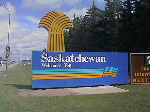

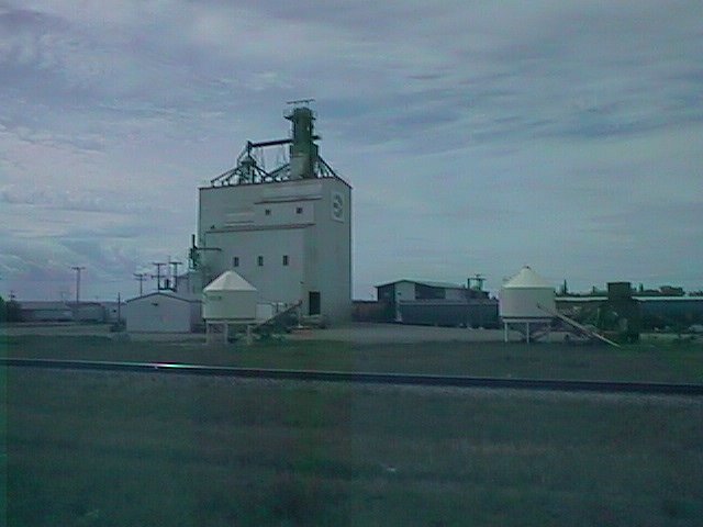
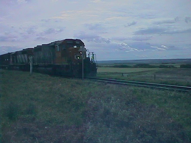
 Small farm towns in Saskatchewan. Today's route passed by several towns
marked as "Population 0-250" on the map. Paynton, Delmas, Denholm, Reddell
and Maymont. I stopped in several and stayed in the last. Each of these
towns had their grain elevator along the railroad tracks. Three or four
other streets of houses and typically a store and a small church.
Small farm towns in Saskatchewan. Today's route passed by several towns
marked as "Population 0-250" on the map. Paynton, Delmas, Denholm, Reddell
and Maymont. I stopped in several and stayed in the last. Each of these
towns had their grain elevator along the railroad tracks. Three or four
other streets of houses and typically a store and a small church.
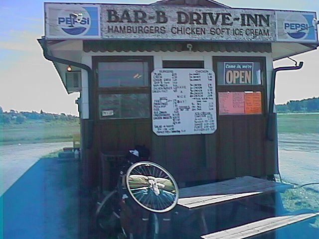
Decided to get on the road before the Maidstone cafe opened. Route
 continued as two lanes along the railroad line. At mile 16, the Paynton
cafe didn't open until 8am, so I continued on to Delmas. At mile 33, the
Delmas cafe didn't open until 9am, so I continued down the road. Finally
stopped in North Battleford. 53 miles before breakfast was a bit longer
than originally planned.
continued as two lanes along the railroad line. At mile 16, the Paynton
cafe didn't open until 8am, so I continued on to Delmas. At mile 33, the
Delmas cafe didn't open until 9am, so I continued down the road. Finally
stopped in North Battleford. 53 miles before breakfast was a bit longer
than originally planned.
Battleford was the big metropolis. The towns of Battleford and North Battleford were on opposite sides of the N. Saskatchewan River. There was a moderate descent and climb crossing the river. Fort Battleford had been an original administration post for the Northwest Territories.
After Battleford the wind picked up. A headwind this time. Slowly picking
up speed as I went to Denholm, strengthening further by Reddell. As the
headwind increased my speed decreased. Finally decided I'd had enough of
fighting the wind when I reached Maymont. Paid $17 Canadian for a room,
record low for the trip.
![]()
 Lots of road miles across the prairies. Easy to do with flat road, large
distances between real towns and prairie winds. Got an early start today
in part because I'd seen a weather forecast predicting 25mph headwinds.
As I looked outside, I saw the leaves rustling and thought uh, oh!
However, I was pleasantly surprised to find tailwinds and not headwinds!
Light tailwinds and crosswinds were the order of business for most all
the day.
Lots of road miles across the prairies. Easy to do with flat road, large
distances between real towns and prairie winds. Got an early start today
in part because I'd seen a weather forecast predicting 25mph headwinds.
As I looked outside, I saw the leaves rustling and thought uh, oh!
However, I was pleasantly surprised to find tailwinds and not headwinds!
Light tailwinds and crosswinds were the order of business for most all
the day.
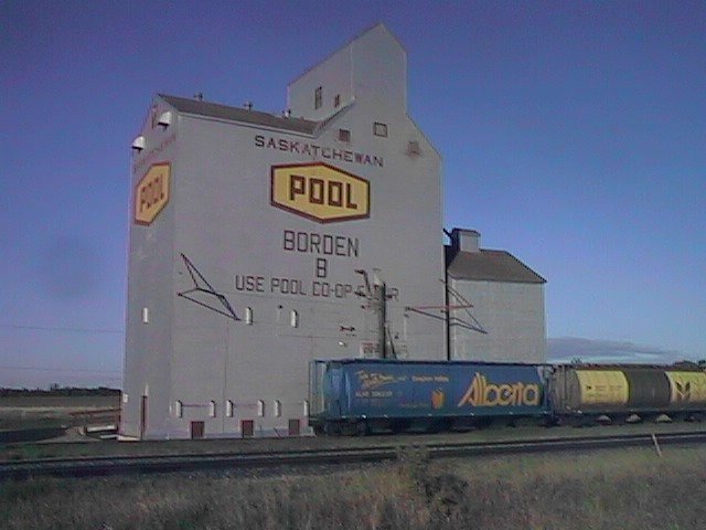
Road passed through farm country past Fielding, Radisson and Borden. Much faster than it would have gone the day before. At Radisson the road went back to one lane each way. However, they were busy constructing the second lane. Much nicer road construction to have it happen on the other lane!
After crossing the North Saskatchewan River again, there was a nice
interpretive exhibit explaining the importance of the river as an early
trading, trapping and exploration route. There was a diagram of whooping
crane flight paths and a tribute marker to early Russian immigrants.
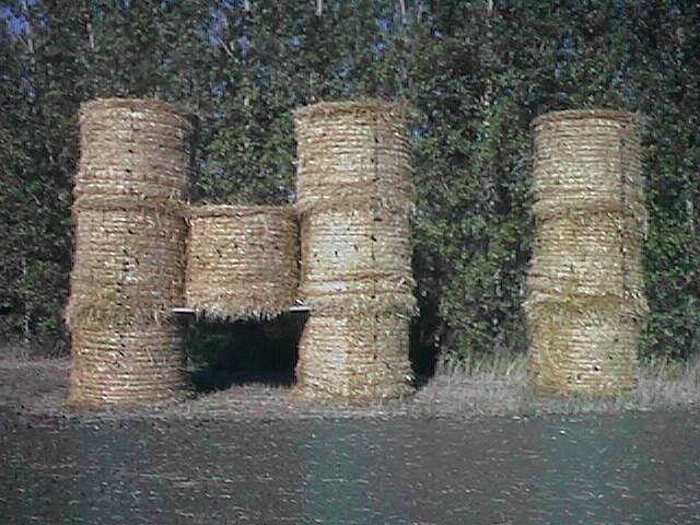 A short while later, there was this display made out of hay rolls.
I stopped to take a picture only to find my rear wheel flat on starting
up again. Glass cut. Decided to swap in a new back tire as the current
one was seeing a lot of wear.
A short while later, there was this display made out of hay rolls.
I stopped to take a picture only to find my rear wheel flat on starting
up again. Glass cut. Decided to swap in a new back tire as the current
one was seeing a lot of wear.
Road was back to double lanes as I cycled down into Saskatoon. Had more of an "interstate" feel as I went into the big city. Luckily, there was a turnoff onto a smaller road. At mile 55 I stopped in for brunch. Mile 63 and I was through the city, phew!
Road became one lane each way and rural right away. Back to the many
 small farm towns. Also several signs of potash mining in the area.
With a light tailwind, I bypassed many of the small towns rather than
stopping. The miles slowly added up. Lucky for me because I also got
the impression there wasn't much left for motels/hotels in these towns.
Passed Elstow, Colonsay, Viscount,...down the road. At mile 120 or so,
saw signs of "International Research Experiment, Saskatchewan Department
of Transportation". Fairly quickly the shoulder became worse. The road
itself had small test sections surfaced in different ways. This is one
research experiment I hope they pave over! Luckily it only lasted a
few miles. Passed a large Potash mine and then made it into Lanigan.
Lots of miles, but not a particularly tough day.
small farm towns. Also several signs of potash mining in the area.
With a light tailwind, I bypassed many of the small towns rather than
stopping. The miles slowly added up. Lucky for me because I also got
the impression there wasn't much left for motels/hotels in these towns.
Passed Elstow, Colonsay, Viscount,...down the road. At mile 120 or so,
saw signs of "International Research Experiment, Saskatchewan Department
of Transportation". Fairly quickly the shoulder became worse. The road
itself had small test sections surfaced in different ways. This is one
research experiment I hope they pave over! Luckily it only lasted a
few miles. Passed a large Potash mine and then made it into Lanigan.
Lots of miles, but not a particularly tough day.
![]()
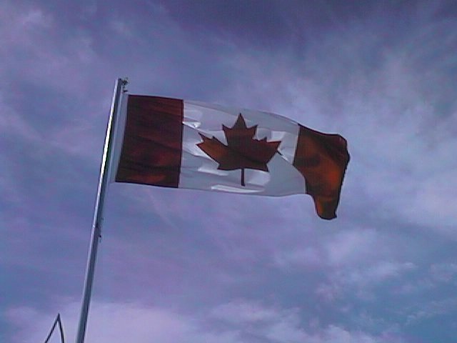
Stiff breeze early when I left. Enough to keep flags flying stiffly.
 This next region had more alkaline soils, occasional marshes and some
cattle. I shifted into low gear and slowly made it upwind to Dafoe for
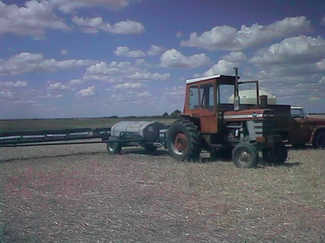
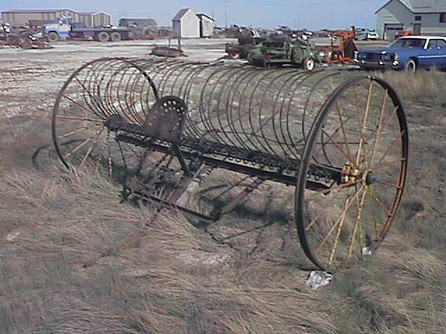
breakfast. This area had been a WWII gunnery and target range. There
was a large collection of old farm equipment here.
This next region had more alkaline soils, occasional marshes and some
cattle. I shifted into low gear and slowly made it upwind to Dafoe for
breakfast. This area had been a WWII gunnery and target range. There
was a large collection of old farm equipment here.
Dafoe was also on the western edge of the Quill Lakes region, apparently the largest salt water lake in Canada. This region is home to many migrating and nesting birds including several endangered species.
Seven miles further was Kandahar named after a British battle in Afghanistan, but now a small prairie settlement. Eight miles after that came Wynyard. It was a little after 11am when I reached Wynyard, but it was tough fighting the wind. I decided I'd take the rest of the day as a rest day rather than fight upwind 30 miles further to Foam Lake.
 Wynyard is a town of ~2100 trying hard to be something big. The visitor
info sign proclaims, "largest town on the Yellowhead in Saskatchewan".
Sunnyland Poultry Products employs ~450 and gives the town claim as
"Chicken Capital of Canada". The Quill lakes area can boast of having
the largest number of Icelandic people outside Iceland. There is a small
museum and also an interpretive center that explained more about the
area.
Wynyard is a town of ~2100 trying hard to be something big. The visitor
info sign proclaims, "largest town on the Yellowhead in Saskatchewan".
Sunnyland Poultry Products employs ~450 and gives the town claim as
"Chicken Capital of Canada". The Quill lakes area can boast of having
the largest number of Icelandic people outside Iceland. There is a small
museum and also an interpretive center that explained more about the
area.
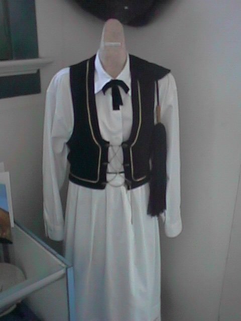
In the afternoon I explored town. I saw the shops on Main St, toured the
museum, and interpretive center. I talked with some friendly folks at
the local fruit stand (good peaches!) For dinner I had boiled "perogies", a
meat/vegetable dumpling severed either boiled or deep fried. Apparently,
a Ukrainian food.
![]()
From Elfross to Foam Lake was a slow grind against the wind. Stopped in
for breakfast before slowly going upwind. Luckily at Tuffnell the road
veered southeast. There were more trees in the area and the wind abated
somewhat.
 I cycled in lower gears but continued to make progress until Sheho where
I stopped for lunch. I saw several hawks including one that looked like
it was being chased by a black crow.
I cycled in lower gears but continued to make progress until Sheho where
I stopped for lunch. I saw several hawks including one that looked like
it was being chased by a black crow.
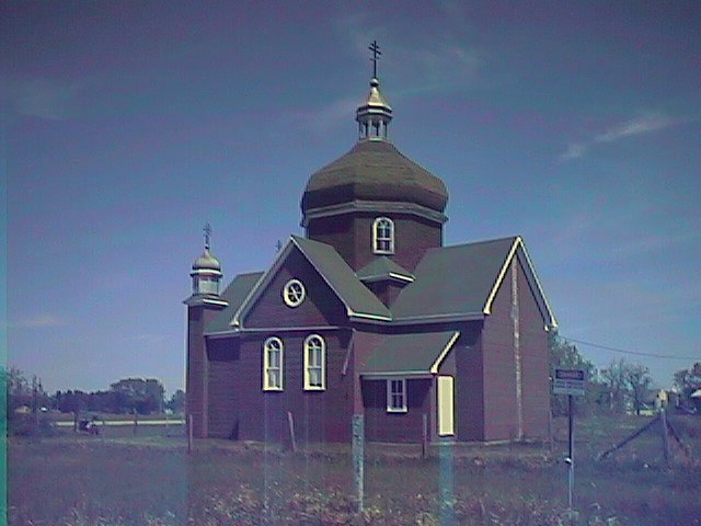 At Insigner was this Ukrainian Eastern Orthodox church. Not too much
else in town. The railroads in this area had put a town every seven
or eight miles. Half of them were very small, mostly residential, but
the others were still going strong. I passed the next towns of Theodore,
Springside and Orcadia before stopping for the day in Yorkton.
At Insigner was this Ukrainian Eastern Orthodox church. Not too much
else in town. The railroads in this area had put a town every seven
or eight miles. Half of them were very small, mostly residential, but
the others were still going strong. I passed the next towns of Theodore,
Springside and Orcadia before stopping for the day in Yorkton.
Yorkton is a town of ~15000 people and the largest in the area.
One motel was full with a local Saskatechwan Government Employees
convention. Luckily space in the next one.
![]()
Left Yorkton early. Already windy. Made my first stop at mile 17 at
the town of Saltcoats. In 1893, Saltcoats became the first official
village in the new North-West territories. Saw a salamander walking
across a side road at the stop. Followed the railroad past Brendenbury
to Churchbridge where I stopped for breakfast.
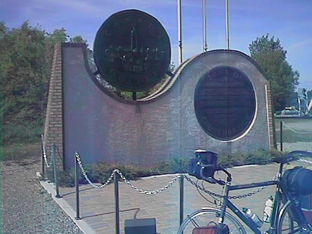 At Churchbridge I found Canada's largest dollar coin. This coin was part
of a monument commemorating a local winner of a contest to design a new
dollar coin for the 125th anniversary of the dollar.
At Churchbridge I found Canada's largest dollar coin. This coin was part
of a monument commemorating a local winner of a contest to design a new
dollar coin for the 125th anniversary of the dollar.
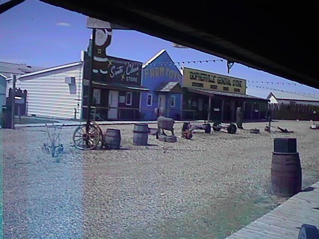 The winds were even stronger after breakfast. A mile past Langenburg
was a tourist trap called "Gopherville". They boasted the world's largest
bike (44 riders, 85 feet long), a Santa store and other attractions.
Stopped and walked around, though I passed on spending $1 to see the bicycle.
(Bet it would work better against this wind!).
The winds were even stronger after breakfast. A mile past Langenburg
was a tourist trap called "Gopherville". They boasted the world's largest
bike (44 riders, 85 feet long), a Santa store and other attractions.
Stopped and walked around, though I passed on spending $1 to see the bicycle.
(Bet it would work better against this wind!).
After Langenburg, road surface became a little worst leading the last ten miles to the Manitoba border. Overall, Saskatechwan roads had been pretty reasonable, almost as nice as Alberta. A few too many headwinds, but otherwise a good set of days.
Manitoba! The province welcomed me with road construction and an unpaved road shoulder. The road also descended down to the Assinboine River only to climb out again. The headwind had strengthened so I was almost in my hill-climbing gears. Reached Russell a little after 3pm and was ready to stop and get out of the wind for the day.